AFFOREST-sDSS
Wiki quality control
| Has flag | yellow |
|---|
Name, responsible organisation and contact person
| Has full name | AFFOREST spatial Decision Support System |
|---|---|
| Has acronym | AFFOREST-sDSS |
| Has wiki contact person | Beyene Belay |
| Has wiki contact e-mail | beyene.belay@yahoo.com |
Software identification
| Has software | AFFOREST-sDSS.Software |
|---|
Description
| Has description | [[Has description::AFFOREST is a project under the European research programme in the 5th Framework Programme. The focus of AFFOREST is on building knowledge and capacity to provide support for decisions regarding afforestation on former arable land in respect to changes in Environmental performance categories and fluxes. To support these decisions the project has developed a mechanistic metamodel (METAFORE) and a spatial Decision Support System (AFFOREST-sDSS), useful for scenario analysis and environmental impact assessment.
AFFOREST-sDSS deals with environmental performance of afforestation on agricultural land in northwestern Europe. The environmental performance of afforestation on agricultural land is defined in terms of three parameters: (1)Carbon sequestration, (2)Groundwater recharge, and (3)Nitrate leaching. It is supranational project, developed in partnership by researchers from Flanders (Belgium),the Netherlands, Denmark and Sweden. The AFFOREST-sDSS is implemented in the Spatial Analyst extension of ArcView GIS 3.2 (Environmental Systems Research Institute, Redlands, CA). The standard version of ArcView GIS 3.2 is adapted by means of its programming language Avenue.The system consists of three different modules (a metamodel, a spatial database and a decision module) and the graphical user interface (GUI). The modules are independent but communicate via Avenue. AFFOREST-sDSS attends to evaluating the environmental impact of the afforestation process by comparing the environmental performance (EP) of the initial system, i.e. the agricultural land, with the EP of the same land after afforestation. There are considered 36 possible afforestation management practices; combinations of tree species choice (pine, spruce, oakor beech are allowed), site preparation and thinning regime. Generally,AFFOREST sDSS succeeds in answering various types of questions concerning multiple aspects of EP following afforestation of agricultural land. Hence it can be used to support related decisions on where, how and how long to afforest.system is limited to the three EICs considered at this stage but thanks to the conceptual structure it can be extended with other environmental and socio-economic impact categories after integration of a new metamodel and new input parameters.]] |
|---|---|
| Has modelling scope | Economical indicators, Forest indicators, Ecological indicators |
| Has temporal scale | Long term (strategic), Medium term (tactical) |
| Has spatial context | Spatial with neighbourhood interrelations |
| Has spatial scale | Forest level, Stand level |
| Has objectives dimension | Multiple objectives |
| Has related DSS | AFFOREST-sDSS |
| Has goods and services dimension | Market wood products, Non-market services |
| Has decision making dimension | More than one decision maker/stakeholder |
| Has forest management goal | afforestation management, carbon sequestration, ecological classification, groundwater recharge, nitrate leaching, species selection, water quality |
| Supports tree species | Spruce, pine, oak or beech |
| Supports silvicultural regime | uneven-aged/plantation, coppice system |
Concrete application
| Has typical use case | N/A |
|---|---|
| Has user profile | forest owners associations, public land managers (i.e. state-owned / federal / cantonal / communal forests), national forest administration, local communities, local administration |
| Has country | Belgium, Denmark, Netherlands, Sweden |
| Has references about examples of application | no |
| Has number of users | N/A |
| Has number of real-life applications | N/A |
| Has utilisation in education | used by students |
| Has research project reference | |
| Has tool dissemination | When a guideline for planning afforestation on previously managed arable land with special regard to water recharge, nitrate leaching, carbon sequestration, and diversity of understory vegetation handed to the users or easily available. |
Decision support techniques used in the DSS
| Has decision support techniques | AFFOREST-sDSS.Decision support techniques |
|---|
Support of Knowledge Management
| Has knowledge management processes | AFFOREST-sDSS.Knowledge management process |
|---|
Support of social participation
| Has support for social participation | AFFOREST-sDSS.Support of social participation |
|---|
DSS development
| Has DSS development | AFFOREST-sDSS.Description of DSS development |
|---|
Documentation
| Has website | http://ign.ku.dk/english/research/forest-nature-biomass/biogeochemistry/afforest/ |
|---|---|
| Has online demo | |
| Has manual | Yes |
| Has technical documentation | Yes |
| Has reference | GILLIAMS, S., J. VAN ORSHOVEN, B. MUYS, H. KROS, G.W. HEIL et W. VAN DEURSEN (2005): AFFOREST sDSS: a metamodel based spatial decision support system for afforestation of agricultural land. New Forests, 30: 33–53.
GILLIAMS, S., J. VAN ORSHOVEN, K. HANSEN, H. SKOV-PETERSEN et B. MUYS (2004): The AFFOREST-sDSS tutorial. K.U.Leuven, Laboratory for Forest, Nature and Landscape Research, Belgium and Forest & Landscape, Denmark. VAN ORSHOVEN J., S. GILLIAMS, B. MUYS, J. STENDAHL, H. SKOV-PETERSEN et W. VAN DEURSEN (2007): Support of Decisions on Afforestation in North-Western Europe with the AFFOREST-sDSS. Book chapter in HEIL, G.W., B. MUYS, et K. HANSEN (Eds.): Environmental Effects of Afforestation in North-Western Europe. Springer Netherlands. Hansen, K. (ed.) (2002). Planning afforestation on previously managed arable land - influence on deposition, nitrate leaching, and carbon sequestration, http://www.fsl.dk/afforest. |
Brief overview
Contents
- 1 Wiki quality control
- 2 Name, responsible organisation and contact person
- 3 Software identification
- 4 Description
- 5 Concrete application
- 6 Decision support techniques used in the DSS
- 7 Support of Knowledge Management
- 8 Support of social participation
- 9 DSS development
- 10 Documentation
- 11 Brief overview
- 12 Scope of the system
- 13 System origin
- 14 Support for specific issues
- 15 Support for specific thematic areas of a problem type
- 16 Capability to support decision making phases
- 17 Data and data models
- 18 Models
- 19 Decision Support
- 20 Output
- 21 System
- 22 References
Scope of the system
System origin
- Universities and research centres belonging to the EU-project AFFOREST
- At the start of the AFFOREST project, potential users (spatial planners active in national and regional administrations, afforestation policy planners and managers of afforestation projects) from the participant lands (Sweden, Denmark, the Netherlands and Flanders) were consulted. This showed as their principal requirements support to select sites and choose among alternative options for afforestation management and afforestation duration with a view to optimise the impacts or performance of afforestation.
- It is free downloadable at the AFFOREST webpage
- does it have real-life application cases
Support for specific issues
Afforestation environmental impact through comparison of three measurements: carbon sequestration, groundwater recharge, and nitrate leaching.
Support for specific thematic areas of a problem type
- Silvicultural
- Certification
- Conservation
- Restoration
- Development choices / land use zoning
- Policy/intervention alternatives
- Sustainability impact assessment (SIA)
Capability to support decision making phases
- Intelligence:
- the system was developed taking into account the foreseen users opinion.
- Design:
- users preferences are asked in order to answer their concerns.
- Choice:
- results enables the comparison between the possible future scenarios resulting from current afforestation decisions, then making easier the decision-making process.
- Monitor:
- not implemented
Data and data models
Typical spatial extent of application
Depending on the AFFOREST-sDSS users needs (administration afforestation policy planners or local managers) there are two possible spatial scales for the application:
- a spatial resolution of 1 ha for a more detailed project planning level, and
- a spatial resolution of 1 km2 for policy planning at the regional scale.
However, if the input data are available or can be estimated with sufficient accuracy and precision, the integrated model can be operated at the first field scale.
Forest data input
Once the study area is defined, it is represented by an ArcView grid. Here, the AFFOREST geographical database provides the basic information, each pixel class of this grid is used as input. This input parameters are derived from soil and land use maps, and geo-referenced sets of data on precipitation, temperature and atmospheric nitrogen deposition.
Type of information input from user (via GUI)
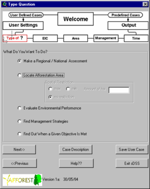
User can specify one of the fourteen type questions. These questions are the fourteen one-, two- or three-parameters combinations of four management specifications: where? (initial system characteristics), how much? (evolution of these characteristics after afforestation), how? (afforestation management), and how long? (time horizon). For each of these combinations asked, the remaining management specifications are required as input. Furthermore, the number of solutions depend on the size of the combination question, e.g. if only one parameter is asked, the three remaining are specified as input, and there would be only a possible solution for this sole parameter.
However, questions can be easily transformed to simple queries to the spatial database if only one of the EICs is of interest or if EICs are addressed as constraints or boundaries. If not, question leads to a complex query which needs the use of mathematical algorithms. In this case, goal programming with interval techniques are used.
Models
Forest models
AFFOREST-sDSS uses the metamodel METAFORE to compute the environmental performance for each initial system in the study area with the data provided by the AFFOREST spatial database.
Decision Support
Definition of management interventions
Decisions supported by AFFOREST sDSS are the selection of sites and the specification of afforestation practices and management, with a view to optimize one or more of the three studied environmental impact categories: carbon sequestration in the ecosystem including biomass and soil, groundwater recharge, and nitrate leaching to deeper soil layers and groundwater bodies.
Typical temporal scale of application
METAFORE model allows the performance of a yearly time step up to 100 years after afforestation.
Types of decisions supported
- Management level
- strategic decisions
- administrative decisions
- operating control decisions
- planning decisions
- organizing decisions
- control decisions
- coordination decisions
- decision making situation
- unilateral
- collegial
- Bargaining / participative decision making
Decision-making processes and models
Simple SQL queries and goal programming (GP) with intervals for more complex queries.
Output
Types of outputs
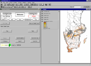
According to the type of question asked by the user the result can either be maps, tables or both.
Spatial analysis capabilities
Data input of graphically selected sites is queried to the AFFOREST spatial database. Non GUI input data apart from managements strategies and simulation goals are required.
Also, AFFOREST-sDSS GIS capabilities are performed when showing results in map forms.
Abilities to address interdisciplinary, multi-scaled, and political issues
AFFOREST-sDSS not only considers afforestation as a mean to yield timber and provide economic benefits, but also account for environmental parameters with increasing social significance.
System
System requirements
- Operating Systems: Microsoft® Windows® 98/ME, Windows NT 4.0, Windows 2000, Windows XP-Home Edition and Professional.
- Other software needed: ArcView™ 3.2
- Development status: finished
Architecture and major DSS components
The AFFOREST sDSS is implemented in the Spatial Analyst extension of ArcView® GIS 3.2. The standard version of ArcView® GIS 3.2 is adapted by means of its programming language Avenue.
The system consists of three different modules (a metamodel, a spatial database and a decision module) and the graphical user interface (GUI).
Usage
The envisaged users of AFFOREST sDSS are afforestation policy planners in national and regional administrations and local managers of afforestation projects.
Computational limitations
AFFOREST-sDSS software and help downloadable package requires some free hard-drive space, taking more than 1 Gb when decompressed.
User interface
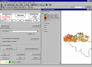
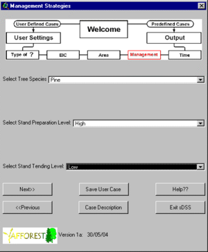
The GUI is a set of newly developed dialog windows that guide end users through the system and helps them to structure their afforestation question into one of the fourteen type questions the system can handle.
Documentation and support
A tutorial and more information can be found in the AFFOREST web-page.
Installation
- Cost: free of charge, non-cost downloadable in the AFFOREST web-page.


